All activities should be supervised by an adult. As an Amazon Associate, I earn from qualifying purchases. This post may contain affiliate links.
India is a vast country with a wonderful variety of geographies. We have everything from snowy mountains and deserts to fertile plains and plateaus.
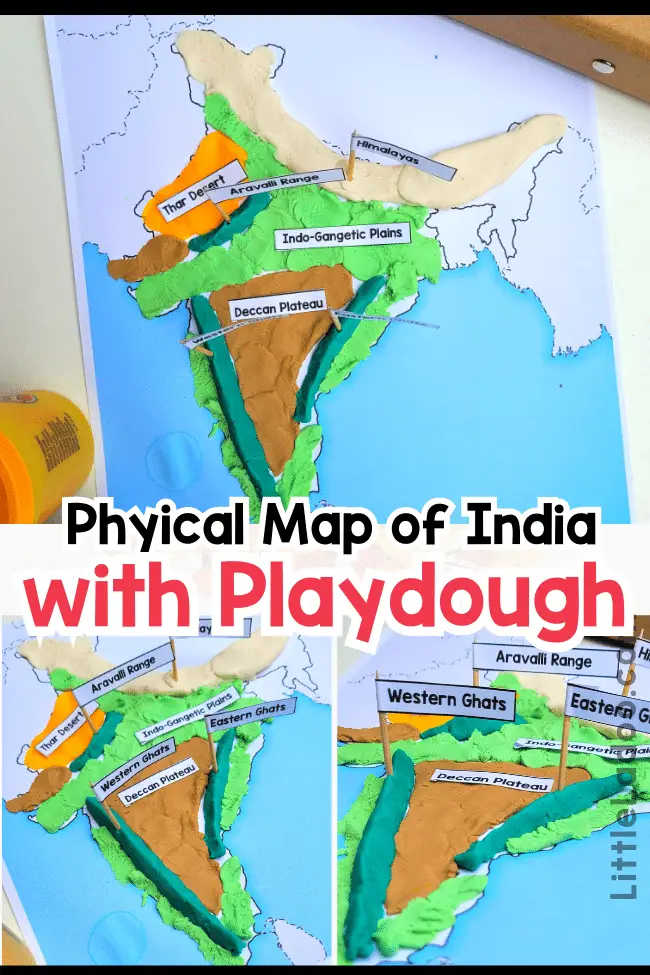
Right now, we’re learning about the different physical features of India in our India-themed unit! One really cool way we’re doing this is by making a physical map of India using playdough on a special printable map.
This hands-on activity helps us remember better by actually doing it.
In this blog, I’ll show you how we had fun making our own playdough map!
You can use this activity not just for India, but for any other country too!
Additionally, take a peek at all the India India-themed crafts and Activities for kids we have available right here!
What is a Physical Map in Geography?
A physical map depicts the natural elements of the Earth, like mountains, plateaus, plains, rivers, oceans, and more. These maps are also known as relief maps.
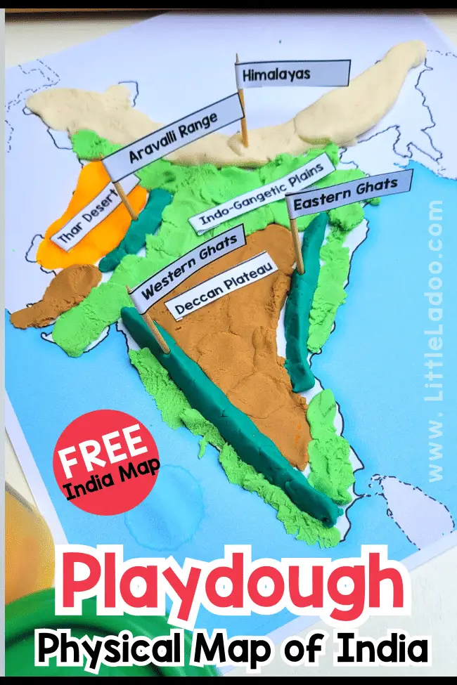
Physical Map of India
India boasts diverse physical features, including towering Himalayan peaks, vast Thar Desert expanses, fertile Gangetic plains, meandering river systems like the Ganges and Brahmaputra, and the Deccan Plateau with its rugged terrain and lush forests.
In our Playdough Activity, we’re going to make and learn about 7 important features in India:
- Himalayas
- Thar desert
- Deccan Plateau
- Indo Gangetic plains
- Western ghats
- Eastern ghats
- Aravalli range
I kept it simple for kids by not adding more mountains and rivers, but if you’re working with older kids, you can add more details. To show rivers, you can just use a blue thread on the playdough.
Keep reading to find out how we made this cool Playdough Physical Map of India!
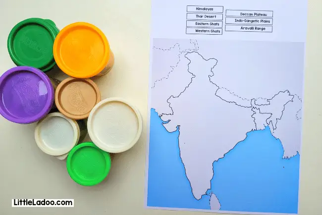
Things you will need to create the Playdough Physical Map of India
- India Map Printable
- Playdough in the colours of Brown, yellow, Beige, Green and White
- Scissors
- Toothpicks
How to Make the Physical Map of India Using Playdough?
Start by downloading the Free printable India map designed especially for this activity. You can find it at the end of the post by signing up.
Print the page on sturdy paper or paste it onto a piece of cardboard.
Get your playdough supplies ready, and let’s begin!
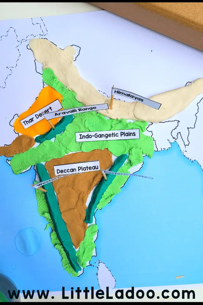
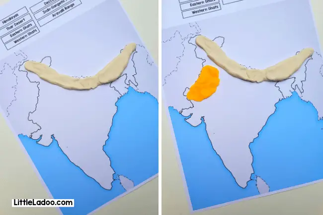
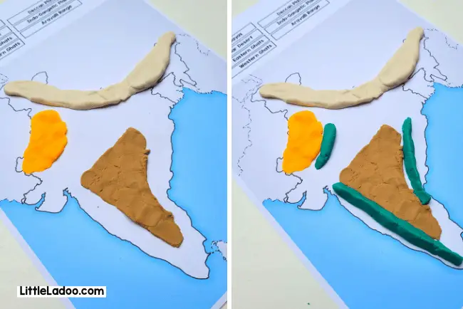
We’ll begin with the impressive Himalayan range that stretches from Jammu to the North-Eastern States. Take a long piece of playdough and press it onto the map, covering the northern part of India.
Next, let’s create the Thar Desert in the Rajasthan region. Roll a piece of yellow playdough and spread it in the designated space.
Moving on, use a shade of brown playdough to represent the Deccan Plateau. Spread it out, leaving some space along the coastline.
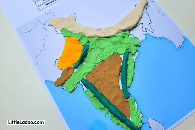
After the Deccan Plateau, position three mountain ranges: the Eastern Ghats, Western Ghats, and the Aravalli Range with green playdough.
Finally, use light green playdough to fill in the remaining space, which mostly includes the Gangetic plains and coastal areas.
To label the physical features, you can create flags using cutouts and toothpicks. You can break the toothpicks in half to fit the smaller map.
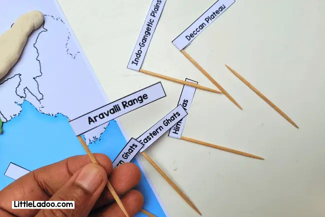
Insert the flags into the map at the correct locations, and your India physical map is ready!
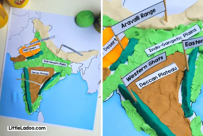
Involve the child right from the beginning, including naming the places, so they remember the information better.
I hope you enjoy this engaging activity!
Remember, you can download the printable at the end of the post. To save this activity for later, feel free to pin one of the images to your India unit Pinterest board.
More India Activities for you
- Learn the location of India, Neighbouring countries and Boundaries with our India Location Worksheets for Kids.
- For more advanced Learning, check out the states and Union territories of India with the India States and UT Pack Flashcards, Location cards and Interactive Maps.
Look Inside India – Busy Book
There is so much information that you can teach your child with this binder. It’s a very handy all-in-one resource to learn about India.
Here is a very Quick preview of the Activity pages of the India Learning binder.
Learn 50+ Geographical Features of India
I discovered an excellent find on Amazon by the brand Imagimake! Children can engage in learning through the intriguing 2 Feet model puzzle.

We already have the States of India Puzzle from the same brand, we’re considering adding this one to our collection during our upcoming trip to India.
It’s worth noting that the base, made of foam, might not be exceptionally sturdy. Nonetheless, the product proves to be a valuable educational tool!
Download the India Map for the Playdough Activity
Sign up in the form below to receive the printable straight to your Inbox!